Prince Edward County, Ontario, Canada
Cedar Sands Trail
THE CEDAR SANDS TRAIL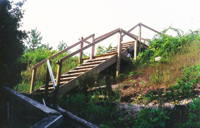 It was in 1972, while employed part time as a weekend relief reporter for the Belleville Intelligencer, that I covered the beginning of the interpretive program at Sandbanks Provincial Park. The highlight was the opening of the Cedar Sands Trail, at the east end of the park. The trail followed the Outlet River for much of its distance, then veered off and ended near what was then known as the Martin’s Gate entrance to the park (that park entrance no longer exists). Once there, hikers had the option of returning via the same route, or following the main park road back to the parking lot.
Today, the two-km trail follows much the same route as it did in its infancy, but now takes a loop near the far end, providing a bit more variety than it did in its early years. The former extension to the old park entrance is still there if hikers choose to follow it, although it is blocked off to direct hikers around the loop and avoid confusion.
Unlike the early years when parts of the trail led hikers through ankle deep water and other low, wet recesses, these areas have now either been re-routed, or made passable through the installation of stairways and boardwalks. One such boardwalk takes the hiker through an area known as a panne, a low wet area between dunes, common in sand dune environments. In spring, this area may become flooded with water, but will be dry during the summer months.
The trail passes through a variety of habitats, including open dunes, lowland forest and passes by the Outlet River Marsh. Two convenient lookouts, constructed through funds generated by the Friends of Sandbanks, give hikers a panoramic view of the cattail marsh, river and some of its inhabitants. The lookouts, as well as a dune crossover, were made possible through a generous payment to The Friends of Sandbanks for use of the park during the filming of Fly Away Home (1996). Over 150 species of plants, as well as many species of wildlife have been found along this trail.
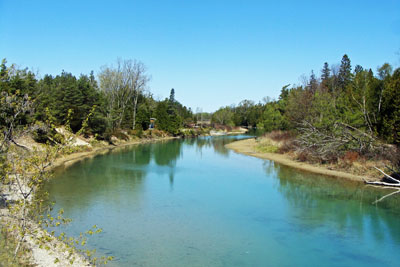 This area of Sandbanks, fondly known as ‘The Outlet” is actually a baymouth sand bar, formed thousands of years ago following the retreat of the Wisconsin Glacier. The Cedar Sands Trail gives hikers an opportunity to investigate and enjoy the rich variety of plants and animals who call the area along this trail home.
An excellent, full colour trail guides for the Cedar Sands Trail has been produced by the Friends of Sandbanks. Numbered posts along the route will help hikers find the features described in the guide. Copies of the guide are available from the dispenser at the entrance to the trail, or can be obtained from either the Nature Shoppe or the Main Office. I would be interested in hearing about any of your flora and fauna sightings along the Cedar Sands Trail. E-mail Terry Sprague
DIRECTIONS:To reach the Cedar Sands Trail from Picton, take County Road 10 (Lake Street) from Picton for 5 km and turn right onto County Road 11. Follow for 9 km to the four-way stop and the Sandbanks Provincial Park entrance. Take the road into the park and follow to the far end and watch for the Cedar Sands Trail parking lot on the left.
