Prince Edward County, Ontario, Canada
Little Bluff Conservation Area
LITTLE BLUFF CONSERVATION AREA
(Photo credits and descriptions of photos can be seen by “mousing over” each photo. )
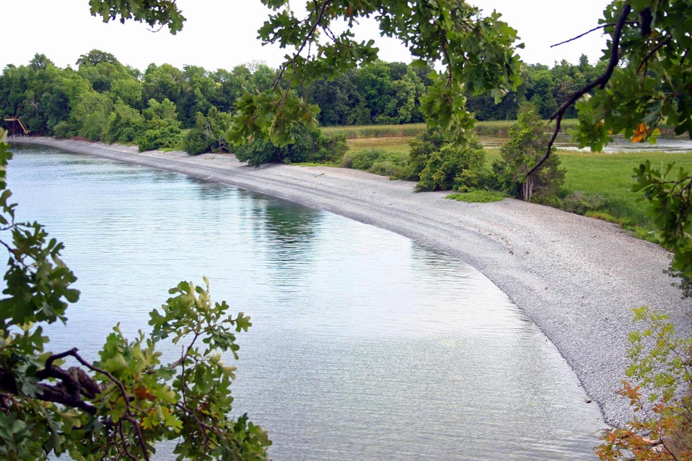
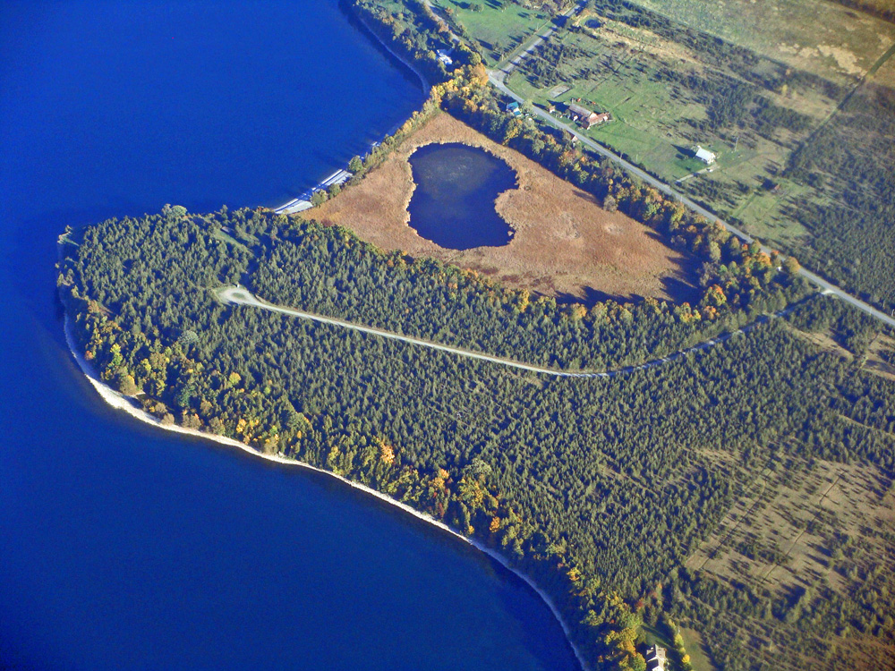 Little Bluff Conservation Areas, despite its remote location near Prince Edward Point, continues to be one of the more frequently visited conservation areas in Prince Edward County. The 70-acre site was set aside by Quinte Conservation (then the Prince Edward Region Conservation) Authority in 1974. Comprising both a high bluff that offers a panoramic view of Prince Edward Bay, the site also boasts a long cobble beach that is very popular for swimming. The cobble beach is actually a barrier beach, formed probably hundreds of years ago by the wave action of Prince Edward Bay, eventually sealing off the tip of the bay behind it. Over time, the back portion, now sealed off, evolved into a cattail marsh. A small pond remains where numerous Mallards and other dabbler ducks frequently gather. The marsh is also home to Virginia rails, Swamp Sparrows, Common Yellowthroats and Marsh Wrens. Joining them are herptiles including Snapping Turtle, Painted Turtle, Leopard Frogs, American Toads, Western Chorus Frogs and Spring Peepers.
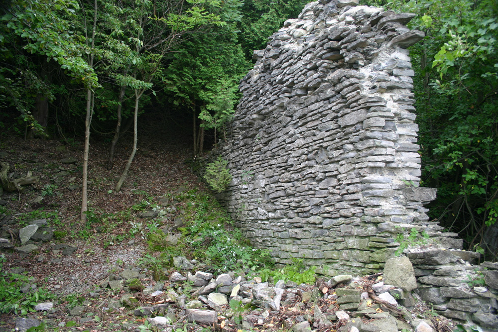
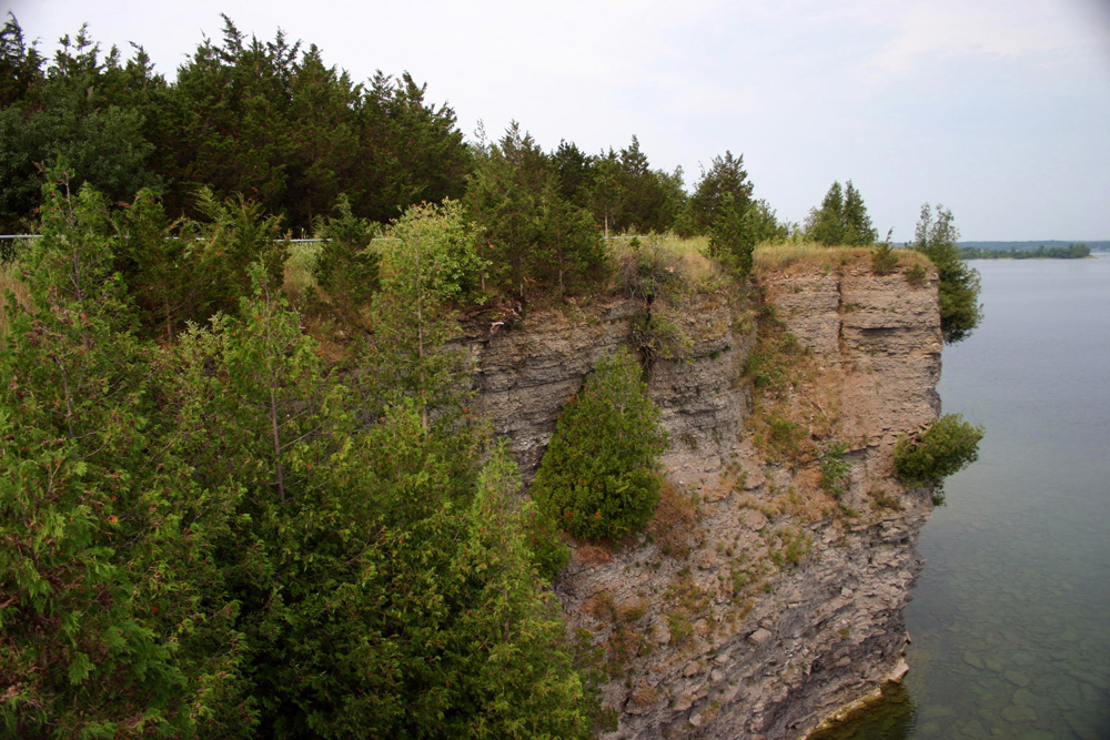
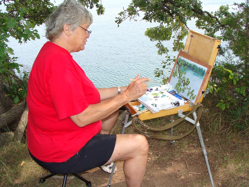 Despite the plethora of Red Cedars that have taken over most of the property, there are some very interesting trails (see map) below, one of them following the upper edge of the escarpment from a lookout near the property’s entrance, and ending at the picnic area. The large and modern picnic shelter is popular with visitors. However, in past years, it has suffered terribly from vandalism, and after being rebuilt, the entrance to the picnic area was closed to vehicular traffic at the parking lot in the hope of gaining some control over the repeated attacks on the structure. It is here, too, where one can follow the steps down the escarpment to the beach below. A portable toilet is provided for visitors during the tourist season. The location some 18 metres (60 feet) above the waters of Prince Edward Bay makes it s a popular destination for artists, like Judy Kent of the Northport area. Another trail from the picnic area continues along the edge of the escarpment and ends at the bottom of the escarpment at the remains of a grain storage building, dating back to the late 1800s. These ruins attest to the agricultural prosperity back then, fondly known as the “Barley Days.”
 Between 1860 and 1890, , the United States was involved in the American Civil War, and the tax on whiskey increased from a modest 25 cents a gallon to two dollars a gallon. As a result American drinkers turned their attention to beer. It was believed that Canada produced superior barley, thus creating an increase in the demand for this crop. In fact, Prince Edward County barley was said to be superior to anything produced anywhere in North America. The 1878 Historical Atlas of Hastings and Prince Edward Counties states, “The land about Bay of Quinte seems more peculiarly adapted to the growth of barley than any other section of America. Crops of that staple are produced which yield fair returns as to quantity, and for quality defy competition; the ‘Bay Barley’ always being, without exception the highest quotation in the American barley centres.”
During this period of prosperity, Prince Edward County alone shipped over 15 million bushels of barley, occupying nearly one-third of the total cultivated land in the county. Pioneer fathers who had never been able to grow a surplus of anything watched as their sons and daughters sold crops for cash in quantities never before dreamed of in the area.
 The remains of the grain storage bin at Little Bluff is just one of many loading areas that were once sprinkled around the shores of Prince Edward County. County boat yards provided the boats to ship the barley across the lake to Oswego, New York, often making three trips per week. One of the major loading areas was the MacDonald/Hyatt Wharf located just across from the large house formerly occupied by Norman and Keith MacDonald, in what is now Sandbanks Provincial Park.
The prosperity associated with Barley Days, however, could not be expected to last forever. In 1890, the McKinnley Tariff gave American farmers protection from importing commodities. In addition, the centre of the brewing industry shifted from New York State to Milwaukee. Barley obtained from the West was found to be adequate in quality and easier to buy. Overnight, the price of barley in the county dropped by 50 per cent. Barley Days were over. The memories though of those 30 years of prosperity will never be forgotten. All it takes is a piece of wharf or a fragment of a storage building to recreate visions of enormous schooners loading up for the trip across the lake.
 If one follows the trail beyond the barley storage building, a seismic station will be found, hidden in amongst the cedars. This is one of about 30 such seismographs in Ontario as part of a geophysical research system called Polaris (Portable Observatories for Lithospheric Analysis & Research Investigating Seismicity). The equipment is linked to a satellite system that connects to the Internet, providing live seismic data for earthquake monitoring. Other similar stations have been set up at Murphy’s Point Provincial Park near Perth, Bancroft, north of Trenton, near Lindsay, Algonquin Park and at Bonnechere Provincial Park. Prince Edward has a number of faults that extend through the county. At least three of these, technically referred to as “pop ups” can be seen clearly from an plane along the Lake Ontario shore near Prince Edward Point as it extends from the fields and out into Lake Ontario.
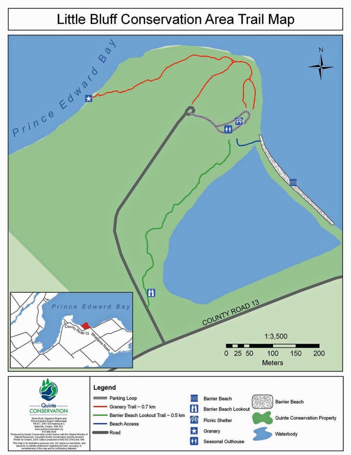
TRAILS:
Granary Trail (0.7 km): The Granary Trail follows the upper edge of the escarpment from the picnic shelter to the barley storage building remains. From the top of the escarpment, the trail goes down a very steep slope to the ruins. However, there is a rope for part of the way to help you along. For many years, volunteers have kept the remains free of encroaching buckthorn, prickly ash and vines. The future of the remains is uncertain as of 2014, the volunteers have all retired.
Barrier Beach Trail (0.5 km): This trail runs along the edge of the escarpment, from the entrance to the property to the picnic area, and overlooks the barrier beach and cattail marsh.
Beach Access (blue trail) The Beach Access Trail runs from the picnic shelter down to the 213 metre (700 feet) cobble beach.
For a printable black and white trail map, CLICK HERE
DIRECTIONS: To reach Little Bluff Conservation Area and its short but interesting walking trails, take County Road 10 (Lake Street) from Picton south for 8 km to Cherry Valley. At the Stop sign in Cherry Valley, turn left and follow County Road 10 for another 6 km to Milford. At the Stop sign, turn left, and then right at the post office, and continue on County Road 10 to the Stop sign at County Road 13. Turn right and follow County Road 13 for about three km and look for the conservation area sign on the left side of the road AT 3625 County Road 13.
* * * * * * * * * *