Prince Edward County, Ontario, Canada
The H.R. Frink Centre, Plainfield
THE H.R. FRINK OUTDOOR EDUCATION CENTRE AND NATURAL SCIENCE SCHOOL
 The H.R. Frink Centre, formerly the Plainfield Conservation Area, was named after the late H.R. (Bert) Frink, a long time educator and principal in Belleville. He always believed that the best way to teach children about nature was through a hands on experience. The Centre is operated by the Hastings and Prince Edward District School Board in partnership with the Algonquin and Lakeshore Catholic District School Board. The Outdoor Education Liaison is an employee of the Hastings and Prince Edward District School Board.
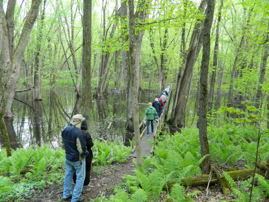
Quinte Conservation owns the land on which the Centre is located. Since 1993, the Friends of the Frink Centre have played an important role by consolidating community support for the Centre and providing the funding necessary for special projects, such as the Wetland Ecology Boardwalk. The Friends of the Frink Centre have expanded outdoor education programs to the community by offering workshops, programs to Day Camps and other youth groups, and Family Activity Days.
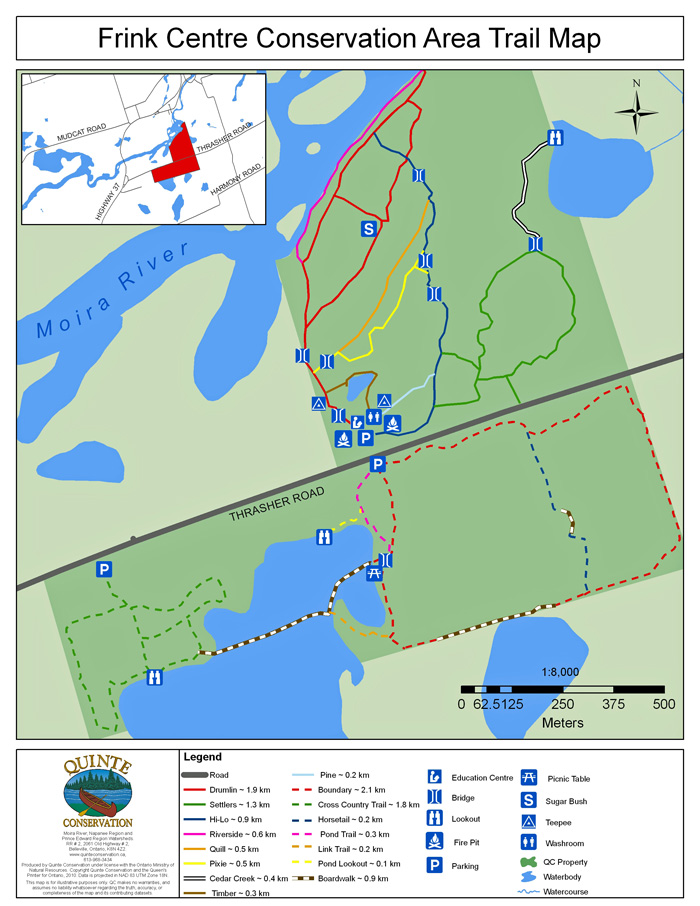
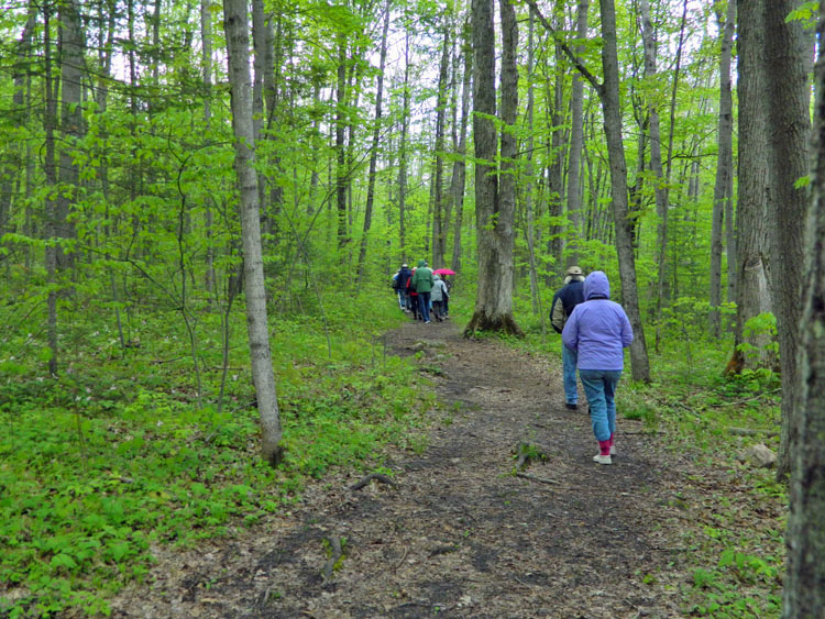
 Although this property is primarily an outdoor education centre, the trails are always open to the public, seven days a week. The main parking lot gate closes at 4:00 p.m. weekdays with walk-through access available every day. The south parking lot is open daily dawn to dusk. Over 13 km of trails on both sides of the road provide access to an incredible variety of habitat, rich in wildlife. The trails are very popular in winter where numerous bird species will be present along with Porcupine, Fisher, Otters, Red Fox, Snowshoe Hare, to name just a few. While not every species may be obvious when walking, their tracks certainly attest to their presence. A bird feeder beside one of the portable classrooms is always alive with birds during the winter months.
The Friends of the Frink Centre have been a tremendous asset over the years in maintaining the trails and organizing activities beyond what is offered through the week for schools.
Have a look at the accompanying map (at bottom of page) and enjoy the variety of sights and sounds that these trails provide.
NORTH SIDE TRAILS
Drumlin Trail (1.9 km) : Follow this trail from the portable classroom with the bird feeder and walk around the major Drumlin of the Frink Centre, through a deciduous forest community where one can see the gradual replacement of Poplar as a dominant species by Maple, Beech, and Hemlock. A Silver Maple swamp stretches out along the eastside of the hill and the Moira River flows along the northwest side. The Drumlin Trail connects with the Hi-Lo self-interpretive trail, the Riverside Trail and the Quill. The number of maple trees along the Drumlin Trail has made it an excellent location for the Sugar Shanty. Pileated Woodpecker, Barred Owl, and Porcupine have been seen along this trail.
Riverside Trail (0.6 km): This trail parallels the Drumlin Trail and reconnects for a short distance, following the shore of the Moira River, then reconnecting with the Drumlin Trail at the far end of the drumlin. It is usually only accessible in late spring, summer and early fall. The Riverside Trail demonstrates the riparian zone where water meets land. This is a great place to go with a set of binoculars and a camera. The Moira River is broad and flows slowly along this section between the Latta Rapids and O’Brien’s Bridge at Highway 37. Wood Ducks and other waterfowl are frequently present here.
Hi-Lo Trail (0.9 km): Access to the Hi-Lo Trail is from the Drumlin and Riverside Trails, and ends back at the parking lot near the portables. The trail takes you through several different communities: succession field, swampy area of primarily shrubs, over a small drumlin, through a Silver Maple swamp, over the main drumlin and along the Riverside trail (during late spring, summer and early fall when water levels are fairly low). The boardwalk across the Silver Maple Swamp is often a good location to see a Barred Owl. Along one low section of the Hi-Lo Trail, there is an interesting rubber tire bridge. These tires were retrieved in the early 1970s from a quarry during a major clean-up.
Pixie Trail (0.5): This is short trial that runs along the east side of the Silver Maple swamp between the boardwalk, later meeting up with the main trail near the portables. The trail runs through a dense stand of White Cedar and mixed forest.
Quill Trail (0.5): The Quill Trail runs parallel to the Pine Trail, and is a good trail to study both a coniferous stand of White Cedars, Balsam Fir and a primarily deciduous forest; look for evidence of porcupines, squirrels, raccoons, woodpeckers, and owls.
Pine Trail (0.2): This short trail runs between the Hi-Lo Trail and the portables. The area along this trail is a favoured habitat of rabbits, hare, grouse and predators of these animals.
Timber Trail (0.3 km): This is the most recent addition to the trail system and encircles a pond, just off the Drumlin Trail near the portables. This trail is named in honour of Vince Prewer (nicknamed “Timber”), an educator who was very much involved with the Frink Centre during its early years. The pond that the trail follows was a favourite location when Vince was actively involved at the Frink.
Settler’s Trail (1.3 km): The Settler’s trail starts and ends at the Hi-Lo trail. The trail takes you through succession fields and mixed forest. To the north is a swamp created when Park’s Creek floods. This trail bears remainders of bygone days (rail and stone fences, wagon wheels and a stone arch used for syrup making). Evidence of deer, coyotes, porcupine and weasels may be spotted along this trail. This is also one of the best trails for early spring flowers.
Cedar Creek (0.4 km): The Cedar Creek Trail runs off from the Settler’s Trail and ends at Park’s Creek where there is a spectacular beaver dam that can be viewed from the observation deck. Waterfowl may be present here and the dense woodland along the way will guarantee a nice variety of birds.
SOUTH SIDE TRAILS
Wetland Ecology Boardwalk (500 metres): The Wetland ecology Boardwalk is accessed from the Pond and Link Trails at the east end and the Cedar Trail from the west. This is a very popular location where there are opportunities to view waterfowl and many species of wetland birds including Marsh Wrens, Swamp Sparrows, Common Yellowthroats and Belted Kingfishers that nest here in this provincially significant wetland. Virginia Rails and Soras are commonly found here in summer. The boardwalk continues and joins up with the Cedar Trail.
Cedar Trail (1.8 km): The Cedar Trail, primarily a cross country ski trail, can be accessed from either the Wetland Ecology Boardwalk, or from a small parking lot along Thrasher Road a half kilometre west of the main entrance (details in Directions below). Birdwise, this trail can be quite prolific with several species of sparrows present. The predominantly red cedar fields, interspersed with hardwoods, a grove of white cedars, dogwoods and sumac lends itself to a good variety of wildlife.
Boundary Trail (2.4 km) This trail a loop beginning and ending at the south parking lot. This trail is one of the less travelled here at the Frink due to its length, and the possibility of travelling through a few soggy areas, but don’t let that deter you as you will see a wide variety of habitats that tend to go unnoticed.
Horsetail Trail (0.2 km) This trail breaks off from the Boundary Trail and eventually rejoins it again taking you mostly through swamp by means of the board walk. Due to the sensitivity of this area it is vitally important that all visitors remain on the trail. This trail is named after the non-flowering Horsetail plant which can be viewed along with orchids, Water Arums, Starflowers and many others during late spring and summer.
Link Trail (0.2 km): The Link Trail is just that, a link connecting the Wetland Ecology Boardwalk to the Boundary Trail.
Pond Trail (0.3 km) The Pond Trail starts at the south parking lot and ends at the beaver pond. It takes you through a succession field and a large beaver pond. Binoculars are a must! Many nesting waterfowl, numerous species of reptiles and amphibians, muskrats, beavers and mink live here. The great diversity of flora and fauna makes this an exciting spot for visitors of all ages. Up until recently, only the edge of the Beaver Pond was part of the conservation area. Now the major portion of the wetland is part of the Frink Centre. The pond trail joins up with the Beaver Trail, the Wetland Ecology Boardwalk, the Horsetail and the Boundary Trails.
DIRECTIONS: Follow Highway 37 north from Belleville for 9 km and turn right onto Thrasher Road. Follow for two km to 381 Thrasher Road. Access to the Cedar Trail is from a small parking lot, almost across from Civic Address #241.
For additional information about the H.R. Frink Centre, and a printable black and white trail map, CLICK HERE.
Learn about The Friends of the Frink Centre **********************
(Photo credits and descriptions of photos can be seen by “mousing over” each photo. )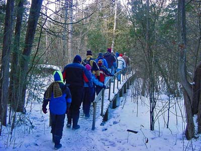
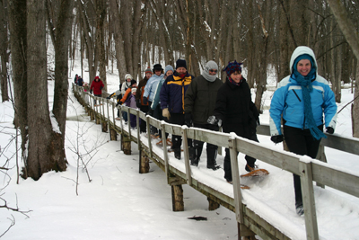 Don’t overlook the coming months for hiking as the trails are always well packed and easy to walk or snowshoe.